The river Onny and the Onny valley lie a little
over one mile north of Craven Arms, on the A49
Ludlow to Shrewsbury road in Shropshire.
A narrow winding river, lush green meadows,
hedgerows and trees, and gently rolling hills
make this quintessentially English countryside.
The area however is perhaps more well known as an
important site visited by generations of
geologists.
In just one mile of river bank, along the
trackbed of the former Craven Arms to Bishops
Castle railway, it is possible to see exposures
of the whole of the Ordovician Caradoc Series
from Hoar Edge grit to Onny Shales
Anyone wishing to make a serious study of this
area should start with "The Geology of the Craven
Arms area" by B.A.Haines, published by the
'Institute of Geological Sciences' (now British
Geological Survey, BGS) as a second edition in
1980.
Haines lists and describes 22 sites but many of
these are not accessible, being located on the
north bank of the river, which is outside the
boundary of the Cheney Longville estate
Another useful guide is the GEOLOGISTS'
ASSOCIATION GUIDE No. 45 "Onny Valley, Shropshire
Geology Teaching Trail" by Peter Toghill,
published in 1992.
Toghill describes a more modest eight sites that
can be viewed from the south bank of the river.
Return to Top
The exposures range from Hoar Edge Grit, the
oldest rock of the Caradoc series in location
No.1, through Chatwall Sandstone (locations 2, 3
and 4). Alternata Limestone (location No.5) named
for its high content of the Brachiopod
Heterorthis alternata , Cheney Longville
Flags (location No.6), members of the Acton Scott
Group including two beds of Bentonite or volcanic
ash (location No.7) to the famous
Ordovician/Silurian unconformity (location No.8).
It was this unconformity in which Onny Shales,
the highest beds of the Ordovician, are overlain
by Silurian Hughley Shales that redefined
Murchison's Lower Silurian as the Ordovician.
Toghill reports that Harnage Shales can be
detected in the highest beds of the quarry at
location No.1 and in the bed of the river Onny at
low water.
Sadly in Sepember 2006, fourteen years after the
GA guide was published, some of the sites were
overgrown and could not be found. Neverless the
trail is a delightful walk and the exposures are
well worth a visit.
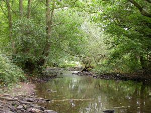
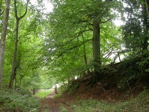
Two general pictures of the trail are shown above
and four pictures of exposures are shown below:-
Return to Top
|
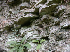
|
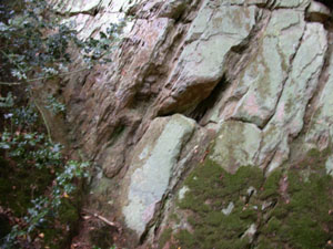
Hoar Edge Grit in the quarry at the western
end of the trail - Site No.1
|
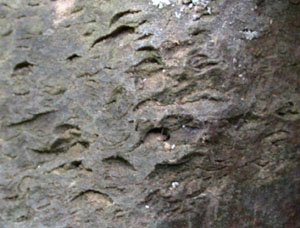
Solution holes where Brachiopods have been
dissolved out of the bed rock - Site
No.4
|
|
|
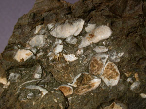
Brachiopods in scree picked up from the
base of an exposure - Site No.5
|
Cheney Longville Flags - Site No.6
|
Return to Top
Access and Safety
Being a public right of way the old railway bed
presents little or no hazards. Care must be
exercised when examining rock faces. Some areas,
notably site No.6, can be very marshy and the
wooden steps in the quarry (site No.1) have
rotted.
From the A49, one mile north of Craven Arms, turn
west, signposted 'Cheney Longville-3/4 Miles'.
Immediately after crossing the railway line to
Church Stretton, turn sharp right into a carpark.
Note: The grass verge at the western end
of the trail (SO 413858), recommended in the GA
guide No.45 as a suitable parking site, is now a
carefully mown lawn in front of a private
dwelling and is unsuitable for parking.